Viewranger - a step by step guide
Viewranger is an excellent GPS and digital mapping app with versions for both iPhone and Android. It has excellent free digital mapping of the Pyrenees. Combined with the GPS tracks we can email you of our Village to Village hike it makes an excellent navigational tool and is perfect for double checking that you're on the right path.
The following is a step by step guide to setting up Viewranger on your phone. This is best done at home on a nice fast interent connection. If you have any difficulties setting things up or you're not sure you've done it all correctly, our guides will help you during your briefing on arrival.
Downloading the Viewranger app and importing tracks
The Viewranger app is free. Although there are premium upgrades available the free version does everything you need to navigate on our Village to Village holiday. Email us at info@hikepyrenees and we'll send you the GPS tracks for the village to Village route.
Step 1

Get Viewranger here, or just search for Viewranger in the App Store or Google Play.
Install Viewranger and open.
Step 2
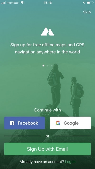
You can press skip if you don't want to create a Viewranger account (app still works fine with no account).
Step 3
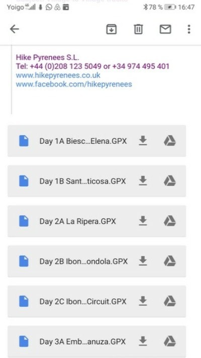
Open the email with the tracks from your phone. For every track, on iPhone press and choose the option 'Copy to Viewranger' or for Android download each track (by default they save to your phone's download folder).
Step 4
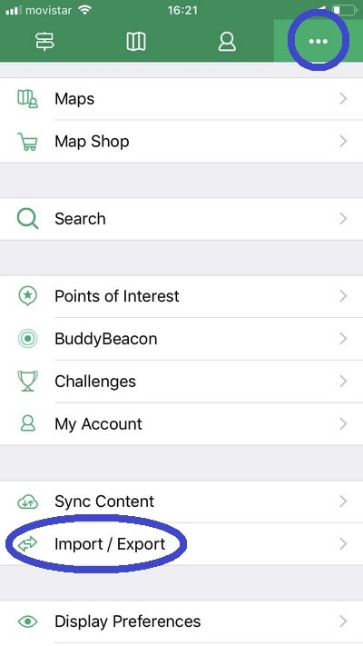
Only needed in Android: From Viewranger, press the menu tab and then Import every track (from external, when asked). On the iPhone if you've copied every track to Viewranger they'll appear in the track list.
Download the map (for offline use in the area)
To use the mapping in the mountains without a data connection you need to download the correct section of map to your phone.
Step 1
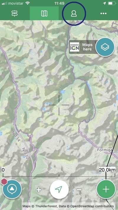
As you open Viewranger, you’ll get to the map screen. Press the profile button (circled above).
Step 2

The 2nd tab is "Tracks", were you will find all the tracks imported. Press on one of them...
Step 3
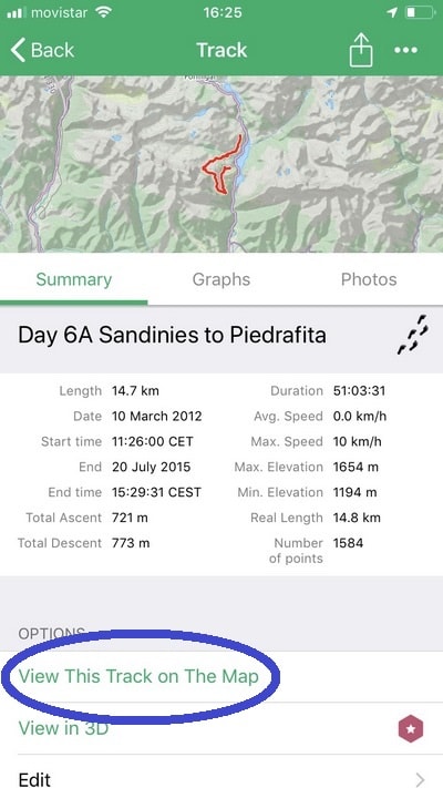
Then scroll (if necesary) to find the option "View this track on the map"
Step 4

You'll get to the map screen again. Now all the tracks you just imported are visible. Press the 'layer' or 'maps here' button.
Step 5
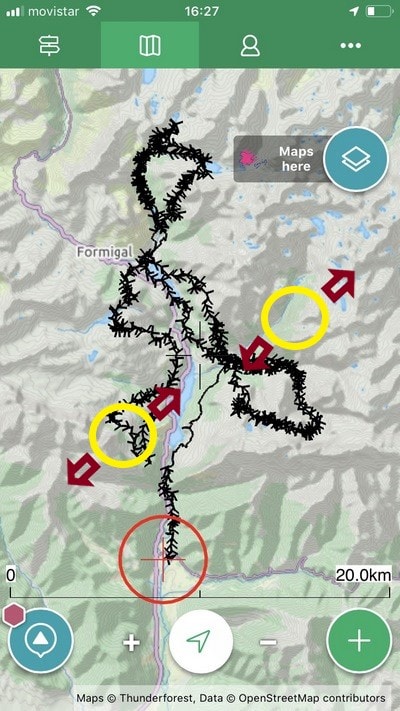
Adjust the area with your finger or using +/- until you have the exact area to see all the tracks.
Step 6

With the Viewranger Landscape maps selected (by defoult), press the first option: "Save for offlline use"
Step 7
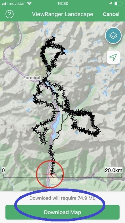
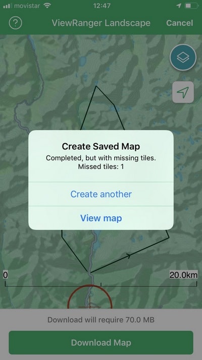
Make sure again all the tracks are in view (re-adjust) and press Download.
Step 8
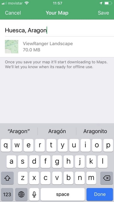
You will be asked to name the map. Then "save" (upper right corner)
Step 9

Downloading the map may take a while (the file size will be around 70MB), depending on your connection and the size of the map.
Some Android devices will pause the download if you touch the screen. If that happens, you have to go the Maps Layer button again, scroll down, press More maps and scroll down again to find your map and restart downloading (skip next picture).
Step 10
When download is over, you can touch de map to start using the app, or press "View map" to see it on the list
Step 11
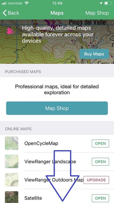
In the maps list, you have to scroll down to find the map you just downloaded.
Step 12
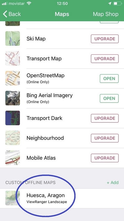
Custom offline maps are at the bottom, after all the online maps. You can manage different options from here, or erase it.
Using Viewranger each day
Each morning on your holiday you'll need to select the track for the hike that you are doing each day.
Step 1
As you open Viewranger, you’ll get to the map screen. Press the profile button (circled above).
Step 2
The 2nd tab is "Tracks", where you will find all the tracks imported. Press the track for the hike that you'd like to do that day - the numbers and names of the tracks match the names on the directions.
Step 3
Scroll down (if necesary) to find the option "View this track on the map" and select.
Step 4
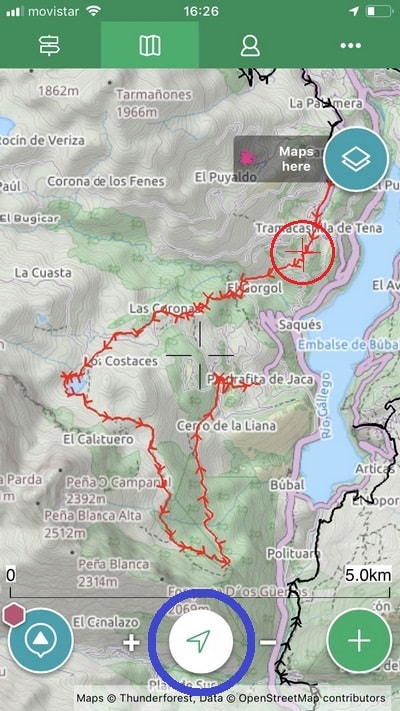
You'll see the map screen again. The track you selected will be shown initially red (sometimes turns back to black as you use the app but that's fine). The red circle and crosshairs show your current position (they will be grey if your GPS location is not accurate - if you are inside a building for example). Make sure that the red circle stays on the red line and you're on the right path!
NOTE: To centre your location on the map press the arrow or crosshairs button at the bottom of the screen in the centre.
Video tutorials
How to locate yourself on the map
How to record a track
How to download an offline map
How to view your trip statistics
FAQ
Do you need mobile connection to use Viewranger?
No, you don't need a mobile connection to use Viewranger. Download the maps and GPS tracks while you are on wi-fi at home or at the hotel. When you are in the mountains you can use everything offline without needing mobile phone coverage or data.
Will Viewranger locate me when I'm out of mobile coverage?
Yes, Viewranger uses GPS satellites to locate you, not the mobile phone signal. Therefore, even when you're away from phone coverage Viewranger will still locate you.
Is Viewranger free?
Yes, although there are premium versions with extra features, the free version along with the GPS tracks we send you has everything you need to navigate in the Pyrenees.
Will Viewranger drain my batteries?
Yes, if you use Viewranger a lot when you are in the mountains then it will drain your batteries. If you just check your position a couple of times a day you'll have no problems with batteries. REMEMBER in an emergency a mobile phone may save your life. Do not run your batteries completely down during the day. We recommend saving one phone amongst the hiking group to use in emergencies and not use for navigating. Another great idea is to use a power-monkey type of charging device. One about the size of a lipstick is quite cheap and will charge your phone a couple of times while in the mountains.
Does Viewranger work on iphones or Android?
Both, there are versions of Viewranger avable on both the Google play store and the Apple app store.
You can find more video tutorials and detailed instructions for all of the Viewranger features on the Viewranger website.