-min")
The formation of the Pyrenees is a tale that stretches back over 600 million years, with the tiny Iberian plate being pushed and crushed by the massive African and Eurasian plates several times through the course of history.
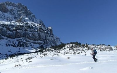
Our guests are always asking about how the mountains we are walking in are formed. For those of you who are lucky enough to have hiked with Juanma, you’ll know he’s our geology expert and gives a great explanation of the formation of the Pyrenees complete with whiteboard (you can tell he used to be a teacher!).
Juanma has written a great article about the geology of the Pyrenees which explains how these magnificent mountains were formed. Below is the potted version or read the full article for the complete explanation.
We hope that you enjoy learning about the formation of the Pyrenees.
The formation of the Pyrenees
Join Our Newsletter
Get updates when we publish new blog articles and information about the Pyrenees
350 Million years +
Emerging lands in the world came together into the “Pangea”. The immense forces began to push up the sea bed giving birth to a huge range known as the Hercynian mountains.

350 Million years +
Emerging lands in the world came together into the “Pangea”. The immense forces began to push up the sea bed giving birth to a huge range known as the Hercynian mountains.

300 Million years ago
The Hercynian range was huge – wider than the current day Himalayas and of similar altitude. Of course as soon as the mountains were formed they began to be eroded flattening the land.
250 Million years ago
A relaxation of the pressure between the plates meant that a shallow sea flooded the now flattened land. This new sea deposited sediments on it’s bed over millennia creating limestone layers.

250 Million years ago
A relaxation of the pressure between the plates meant that a shallow sea flooded the now flattened land. This new sea deposited sediments on it’s bed over millennia creating limestone layers.

65 Million years ago
The African plate pushed north, pushing the Iberian micro plate into the large Eurasian plate. This lifted the sea bed once again forming the Pyrenees mountain chain. The high mountains were now formed but we wouldn’t have recognised these mountains and there was one final stage in the process.
65,000 years ago
Glacial and fluvial erosion occurred, has continued to the present day and is still shaping the landscape. Huge glaciers carved through the soft limestone forming valleys such as Ordesa, Pineta and the Serrablo. Rivers did their work too creating the Añisclo Canyon and many others and finally forming the Pyrenees we see today.

65,000 years ago
Glacial and fluvial erosion occurred, has continued to the present day and is still shaping the landscape. Huge glaciers carved through the soft limestone forming valleys such as Ordesa, Pineta and the Serrablo. Rivers did there work too creating the Añisclo Canyon and many others and finally forming the Pyrenees we see today.
Cross section of the Pyrenees
This diagram shows a north-south cross section of the Pyrenees and the types of rocks that form each zone. This is specifically the Valle de Tena and the pre-Pyrenees but most areas will have a similar make-up.


The Ibones de Arriel lie in one of the exposed granite areas on the French/Spanish border. As the granite is not as porous as the limestone which dominates many areas of the Pyrenees, it allows these beautiful mountain lakes to form.

The white marble summit ridge of Picos los Infiernos is simply stunning to walk across. You can clearly see the difference between the marble and the darker schist beyond. In the distance to the left you have the ancient volcanic horn of Midi d’Ossau, one of the most famous and recognisable peaks in the Pyrenees. On the right you have the granite ridges and summit of Balaitous.
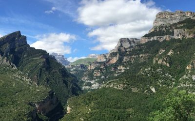
The Ordesa NP
Guide to hiking the spectacular canyons of the Ordesa National Park
Bearded vulture
This huge bone eating vulture is one of the Pyrenees emblamatic species

Great article Phil. I am fourth from the left in your photo ! Health condition prevents me from ever returning to see you all once again. Stay safe and well in these trying times