
2019 GR11 Snow conditions update (posted May 28th 2019)
We’re starting to get people asking about snow conditions on the GR11 route for the 2019 season so I thought I’d write a quick update.
The Pyrenees in general had less snow than normal this winter. However, temperatures in May have been fairly cool without that much rain. With the colder temperatures, the rain we have had in the villages has fallen as snow above around 2200 metres. Therefore we have a situation where below around 2200 metres there is much less snow than normal – espceially on south facing slopes – but above this there is still significant snow and I would say conditions are more or less normal this season higher up. North facing slopes in particularl still have plenty of snow and crampons and ice axe are definitely needed on the higher sections.
Below is the webcam (taken today 28th May) from Refugio Respomuso towards Collado de Tebbarai (at 2782m one of the higher passes on the route – this is the northern side). I’ve drawn on the approx. route of the GR11. As you can see there is still substantial snowfields and I personally wouldn’t be crossing this without crampons.

Snow conditions on the GR11 from Refugio Respomuso
Everyone have a great time on the GR11 – stay safe and make sure you are properly equipped for conditions. In times when you can’t go out and hike, try and play online slots games indoor. It is a great way to calm your mind when you want to get out.
Enjoy your hiking and the Pyrenees and let us know how you get on!
—————————————————————————————————–
The GR paths are a network of extensive paths that criss-cross Europe, mostly in France, Belgium, the Netherlands and Spain. In Spain, GR stands for ‘Gran Recorrido‘ and here in the Spanish Pyrenees, we have a number of these GR paths linking key settlements, passes and valleys, but perhaps the most challenging and impressive of these GR routes and the one that many of our hikes are based around is the GR11. The GR11 stretches the entire length of the Spanish Pyrenees, from Hondarribia, on the Atlantic coast to Cap de Creus, on the Mediterranean coast, and covers a total of 840km, which is divided into 46 day long sections, most of which start/finish where accommodation is available, either a campsite, town, refuge or hostel.

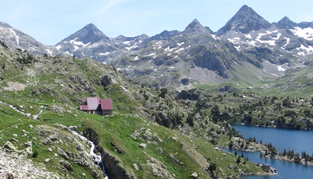
Circo Piedrafita, near Refugio Respomuso is one of the higher sections of the GR11
How long will take?
This does depend, to an extent, on your fitness, need for rest days and whether you wish to take some of the spectacular peaks along the way, but 45-60 days is the norm, however, it has been completed in a little as 24 days.

The GR11 runs through the magnificent Ordesa Valley
What to expect
The GR11 passes through the mountains of Navarra, Aragon and Catalonia, the latter two regions comprising of steeper and higher mountains, not to mention a hotter climate than Navarra. There are a number of high passes, above 2500m, in the central section and as much as 1600m of ascent / descent in a single day. The GR 11, is a much more recent path than the GR 10, which lies on the French side of the Pyrenees, and offers more wilderness, passes through less villages and probably has better weather!

Fuen Blanca is situted towards the head of the Anisclo Canyon and is one of the most remote spots along the GR11.
The GR11 is generally well marked throughout with red and white stripes, however, it would be foolish to head out without an understanding of mountain navigation, along with a map and compass. The terrain underfoot varies hugely, from straight forward 4×4 tracks, through to exposed and narrow rocky paths in high mountainous terrain, where a slip would be very serious.

Red & White stripes mark the GR11
When to go
The main walking season in the Spanish Pyrenees is between late May and the beginning of October, however this is not a hard and fast rule, as there can be snowfall well into June, and again in late September, which can cover many of the red and white painted markers. On the other hand, there may be some perfect windows of opportunity in the autumn, particularly as the temperatures will be cooler.
There will be unavoidable snow patches throughout June and probably well into July, and these should not be underestimated. Those looking to hike the higher sections of the GR11 during this period should carry both an ice axe and crampons, and have experience of using these. The presence of snow can turn a benign scree slope into a steep icy slope, which without the use of an ice axe and crampons could be potentially very serious should a slip occur. An example of is on the slopes leading up to the Cuello Tebarrai (2782m) from Refugio de Respomuso, which can hold snow until early August. Following a winter and spring of heavy snowfall, avalanche hazards can exist into June, particularly on hot, sunny days. Hut guardians can often be a great source of information regarding the conditions of the GR11 in the vicinity of their hut.
The Hike Pyrenees blog often has up-to-date photos and information regarding conditions in the Aragonese Pyrenees.

Photo of the Circo de Piedrafita & Embalse de Respomuso taken in June 2013

Heading up to the Cuello Teberrai in July 2013
Wardened Huts or ‘Refugios’
The wardened ‘Refugios’ along the GR11 will play an integral part of the journey, and will no doubt be a welcome site after a long day of hiking. These should be booked in advance, either on-line or by telephone, and notified as soon as possible if you plan to cancel your booking also there are other activities like playing games or gambling in sites like w88 online. The facilities available do vary from hut to hut, but do remember that these are often located high in the mountains, where supplies are brought in either via helicopter or by mule. Some have showers and all will have a Plastic portable toilet in the location. They will all offer meals (including packed lunches) and often run a restaurant/bar service during the day. Prices are very similar from hut to hut and are as follows:
Overnight: 17 euros
Dinner: 17 euros
Breakfast: 6 euros
There is a certain etiquette for using mountain huts, and whilst they vary slightly from hut to hut, overall the following rules will help:
1) Check-in on arrival, where you will be allocated a bed within a specific dormitory. Let the warden know what time you’ll be up in the morning.
2) Boots are not permitted inside the hut, instead change into hut slippers or your own sandals.
3) Rucksacks are often not permitted inside the dormitories. Leave these in the designated areas (sometimes lockers) and only take what you need for the night to the dormitory.
4) Use a sleeping bag liner when sleeping, and ear plugs are a good idea!
5) Lights will all be turned off at about 10pm, make sure you have a head torch to hand.
6) In the morning, leave the dorm quietly, trying not to disturb others.
7) Take all your rubbish with you, otherwise someone else will have to.
It is worth noting that if you plan on spending many nights in mountain huts, to consider joining one of the large mountaineering organisations which provide reciprocal rights I.e. discounts of up to 50%. The Austrian Alpine Club (UK) is one such organisation.
-

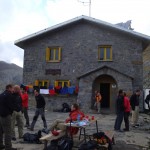
- Refugio Respomuso
-

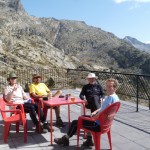
- A well earned beer
-

- Refugio Angel-Orus
-

- Refugio Viados
-

- Refugio Estos
-

- Refugio Bachimana
-
- Refugio Goriz
-

- Hut life inside
-
- Hut life outside
Variations and summits
There are an infinite number of variations possible, with all the official variations are listed here: http://www.euro-senders.com/web_eng/grspain/gr_011.htm and described in the guidebook The Gr11 Trail – La Senda: Through the Spanish Pyrenees (Cicerone Guides). These variations will generally be for one of three reasons: 1) the variation will be a more enjoyable and scenic, 2) the variation will be more logical, e.g. not loose unnecessary height to then reascend soon after, 3) the variation will be more convenient for using wardened huts.

Hiking along the GR11.2 in the Posets Massif
Along with these variations, there are plenty of opportunities to take in some of the great Pyrenean summits, including: Pico de L’Infierno, Monte Perdido, Pico Posets, Perdiguero & Pico Aneto. Needless to say that extra time will need to be factored in, as most of these summits are side-trips (up and down the same route) from the GR11.

The impressive Pico de L’Infierno.

On the summit of Monte Perdido, 3355m
Kit
As with any trip of this nature, what you take depends on how you choose to play it, but the bottom line is to keep things as light as possible. The entire trip, from coast to coast, can be done, with careful planning, without carrying a tent or sleeping bag, however, this could well involve some big days of 30km+. There are plenty of resources in books and on-line that detail what you should take, but here are a few things to consider:
Rucksack: Needs to be big enough to fit all your gear in, but not so big that you end up filling it with unnecessary items. 55-65 litres should be ample. Contents should be kept in waterproof dry bags or a liner.
Sleeping bag: Only required, along with a lightweight sleeping mat, if you plan on camping along the way. A 3 season bag should suffice.
Sleeping bag liner: You must have a sleeping bag liner for the wardened huts (they provide blankets). This should ideally be a silk one, as they are very light and dry very quickly.
Boots: Must have good ankle support and a sturdy sole, as some of the walking will be on very rough or loose terrain. These will need to be stiff enough if you plan on using crampons.
Sun hat: Absolutely essential! The sun during the summer, at midday can be blisteringly hot, and without adequate protection, dehydration, sun burn and heat exhaustion are all much more likely.
Waterproofs: Again, absolutely essential. Don’t forget that just because you’re in Spain, during the summer, that you’re still in the mountains, where the weather can change very quickly, and whilst overall, it doesn’t rain much, when it does, it can be very heavy. That said, heavyweight mountaineering waterproofs are a bit of an overkill, go for something lightweight and breathable. This applies to waterproof trousers too.
Other essentials: map & compass, pure contact lenses, sunglasses, headtorch, at least 2 litres of water per day.

Hiking in the sun from Refugio Goriz
Books & Maps
Senda Pirenaica: GR11 Long Distance Path by JA Lopez Lafuente is one of the most comprehensive Spanish guidebooks to the GR11 and contains maps for each of the 47 stages.
Trekking in the Pyrenees (Trailblazer) by D Streatfeild-James covers both the GR10 and GR11 and includes all the practical information you need.
The Gr11 Trail – La Senda: Through the Spanish Pyrenees (Cicerone Guides) by B Johnson is another very comprehensive book that focuses solely on the GR11.
Useful websites
www.alberguesyrefugiosdearagon.com – for booking refugios in the Aragonese Pyrenees
www.lacentralderefugis.com – for booking refugios in Catalonia
www.yr.no – a very comprehensive weather website
www.mountain-forecast.com – another comprehensive weather website, locations are by mountain
Hi, do you happen to know if the eastern part of the gr11 (say the eastern most week of walking) would be OK to walk during the 1st week of Oct?
Your help would be very much appreciated!
Hannah
Hi Hannah,
You should be absolutely fine walking the eastern most section in the first week of October. It’s just about the time we’d expect the first serious snowfalls in the higher sections at the centre of the range but at either the eastern or western ends of the route you should be fine.
Have a great time hiking the GR11!
Phil
Is it possible to take dogs hiking in the Pyrenees and along the GR 10..??
Hi Jamie, the answer isn’t yes or no really. It is very possible on the Spanish side along the GR11 and other paths however they aren’t allowed into the refugios as a day or overnight visitor. For Ordesa national park, when the shuttle buses are running during the peak summer season, dogs are not allowed on the buses but are allowed in the park as long as they are on a lead (it is possible to walk up to Ordesa from Torla however it’s an additional 8km round trip). The French side is different, dogs aren’t allowed in a fair few areas so hiking along the GR10 with a dog would be difficult.
Hi Jamie,
Dogs are allowed in the majority of the Pyrenees aslong as you are outside of the National Parks. You need to be sensible and keep dogs on a lead when near livestock.
Dogs are not allowed (even on a lead) in any part of the Parc National de Pyrenees on the French side and the GR10 passes through large sections of this. In the Ordesa National Park on the Spanish side dogs are allowed on leads (however aren’t allowed on the shuttle bus that runs to the Ordesa Valley during summer!).
Here in the Valle de Tena our guides Ken and Hannah have a dog, Inca, and often take her out hiking with groups – she gets put in the rucksack if it’s a long day and can’t manage it all!
Hope that helps – enjoy your hiking in the Pyrenees,
Phil
Thank you Hannah and Phil…
Hannah and Phil,
A small group of us are planing 10 days in September along the GR11. We are thinking of spending two nights at a couple of huts to take in a couple of summits, So maybe walk seven legs of the GR11.
Could you recommend a good section (start and finish) for such an adventure.
Kinds Regards
John Barry
Hi John,
Sounds like a great trip you are planning. I think one of the best one week sections of the GR11 is starting at Sallent de Gallego in the Valle de Tena and continuing as far as Benasque. This is 7 stages and passes through some of the wildest and highest sections of the route. It’s quite tough with pretty long days but the scenery is superb. You pass through the Ordesa National Park and then the Posets-Maladeta park passing right underneath Posets (the second highest peak in the Prenees), finishing with Aneto (the highest peak) right in front of you.
There are several excellent peaks that you can do as side trips. From Refugio Goriz in Ordesa you can do a number of 3000 metres peaks – the most popular is Monte Perdido (3rd highest in range) but there’s several other including Taillon which takes you through the Brecha de Roland. From Biados (a beautiful refugio) you can take in Bachimala and then if you take teh GR11 alternative that stays at the Angel Orus hut you can do Posets which isn’t technically difficult from that side of there is no snow.
September is a good time to go and the route will be as snow free as it gets – Id expect you to be able to do Posets and Perdido without crampons in September but you never know so check conditions with the hut wardens.
The Goriz hut in particular gets very booked up – make reservations in advance.
Another good thing about this section of the route is that you can get to the start and end relatively easily by public transport. For Sallent get a bus from Huesca or Zaragoza to Sabiñánigo and from there either a bus (2 a day) or a taxi (about 25 euros) to Sallent. Benasque is a reasonably big village and has several buses a day. Look at http://www.alosa.es for bus times (you can only see them one month in advance but the times don’t change much throughout the year).
Hope that helps. Have a great trip – take care with this route as you are straight into the high mountains with no warm up in the lower parts of the range near the coast.
Cheers,
Phil
Hi Phil and Hannah
My fiancee James was one of your very first customers back in 2008 and he has raved about his holiday with you in the Pyrenees ever since!! 7 years later and finally we’re both coming out to walk the middle chunk of the GR11 together (from Candanchu to Puigcerda) in late July & August. We would love to do some other outdoors adventure activities whilst in the Ordessa region – in particular canyonning but not the Via Ferrata (apparently this was very scary!). Is there anything you can recommend?
Thanks so much
Rosie
Good Day,
I will be camping in Solsona and hope to do some hiking day trips from there. Are there any sections of the GR11 nearby? Thanks for your time.
Hi Rosie,
Thanks for your comment – I remember James well he was on one of our first ever holidays. Anna took him on the via ferrata at Broto and I remember her saying his legs looked a little wobbly at one point!
Great that you’ll be doing a section of the GR11 and that’s a great part to do.
For canyoning there’s two places I can recommend (although probably plenty more that I don’t know as you get across to Catalonia). As you cross through the Valle de Tena you’ll probably stay a night in Sallent de Gallego. There’s a good canyon near called Gorgol – good first canyon, not really hard but very pretty, deepish limestone canyon and with a bit of everything (abseils, junmps, etc). There’s an adventure company actually called Gorgol in Sallent (www.gorgol.com) that organises canyoning trips there.
Another good canyon is Furco which is just south of Torla (this may have been teh one that James did I can’t remember) which is also good – bigger jumps and abseils -it’s in flysch rather than limestone. There are a couple of adventure companies in Torla and all will run trips there. There is another canyon nearby Furco called Sorrosal which is the one that ends with the huge waterfall that the via ferrata crosses over – this is pretty extreme and I wouldn’t recommend.
Tell James to drop me an email and let me know when he’s in the area – be good to meet up for a beer.
Have a great time on the GR11,
Phil
P.S. – book up Refugio Goriz in Ordesa asap – I was booking some nights there yesterday for a group and they are already full for over half of July and most of August.
Hi Cavel,
Solsona is a bt far south to reach the GR11. It’s just south of a good area called the Cadí Moxieró park which has some excellent hiking. The main peak there is called Pedraforca which was the first mountain I ever did in the Pyrenees. It’s a superb double peaked mountain and the final section to the summit is a fairly exposed scramble. If you’re not up for hands on rock there are plenty of other good routes in the park.
Have a great time in the Pyrenees,
Phil
Hi there,
Thanks for all the helpful info on your site.
I’ve been wanting to travel to Ordesa to do some hiking, as it sounds like a great section of the GR11 to see. For the moment though I’ve only got around 5 days from Barcelona in the first week of June to play with and am wondering what can be done in the Pyrenees with that… seeing as there will still be snow in places, and how long it takes to get out there from the city etc.
Can you recommend any closer sections or something to suit a shorter itinerary at that time of year? Any suggestions would be much appreciated!
Thanks in advance, all the best,
Sarah
Hi Phil and Anna
My husband and i want to hike in part of the GR11 in late July, early August, for 10 days or so.
What part would you recommend to do and how can we get to the beginning of the section from Barcelona (by Public transportation)?
Is it possible to finish the hiking in Andorra la Vella?
Thank you,
Tal
Hi Phil,
I am considering doing a big part of the GR-11 in my upcoming June holidays. Plan would be to start on the 1st of June from Benasque and working my way east into Andorra (the high section). My concern is the high mountain passes. My regular equipment includes clamp ons and walking sticks (but no ice axe). Would it be proper equipment or too light this year (last year I remember snowfall very late in the season).
Best regards, Robbert
Hi We are planning to set off in mid June on the GR11, Do you have any information on the snow conditions this year on the higher sections? Many thanks
Hi Robbert
The 1st June is quite early to start the GR11 particularly if you are starting at Benasque which is the highest section of the Pyrenees. In general I would say that the snowline is a bit higher than normal as this spring we’ve had little precipitation and the temperatures have been quite warm. However in the cols and gullies the snow collects – particularly if they are north facing. Also there’s still time for fresh snow up high – it’s currently snowing in the valle de Tena down to about 2300 metres – I don’t thinkmuch of this sill settle as the ground warms up but higher up where it’s falling on existing snow it will settle.
If by clamp ons you mean little spikes that you attach to your boots with a rubber/elastic strap then these aren’t really sufficient. The snow annoyingly always tends to be on the steepest sections! Personally I’d be taking ice axe and crampons at this time of year to avoid any doubts and know that I can cross any snowy sections.
The huts are a good source of information – if you speak Spanish gve the huts next to the high passes a call a week before and they’ll be able to advice on conditions. Many also have good Facebook pages where they put updates on conditions. Also take a look at the webcams on the Refugios de Aragon site (the link is in the article) as this will give you a good idea of how much snow is around.
Hope that helps – have a great and safe trip,
Phil
Hi Peter,
If you’re starting mid-June at the coast it will be late June by the time you reach the higher sections. The snowline is currently a bit higher than usual but as I mentioned in my repy to Robbert the snow tends to linger in the cols and gullies. Give the huts a call before you set out to check conditions and take a look at the webcams. Refugio Respomuso has a webcam pointing towards the north side of the Collado de Tebbarrai which is one of the higher cols – this should give you a good idea of how much snow is around.
Cheers,
Phil
Update:
To give you an idea of snow levels below is a link to an image taken from the webcam at Refugio Respomuso pointing towards the Collado de Tebbarai – photo taken 17 May. I’ve marked where the col is and roughly where the GR11 goes. The webcam is at 2200 metres and the col is at 2782 metres. Although there’s less snow than normal this year you can see the path still passes through quite a bit of snow and it’s reasonably steep on this section – I definitely would be taking crampons to cross this at the moment.
Refugio Respomuso webcam image
And here’s a link to the webcams of all the refugios in Aragon so you can keep a check on how conditions develop:
Refugio Webcams
Hi Phil,
Thank you for the excellent advice. It is quite early, but unfortunately this is the holiday period that I have, so if it is possible I will give it a try. Calling the refugio is definitely good advice which I will do.
Best regards, Robbert
Hello!
Is there a section of the GR-11 that you could recommend for my friends and I in the central section of the Pyrenees? We are planning a trip for early/mid-July, and are looking to be on the trail for about 7 days. We have decent experience, but would like to avoid any need for ice picks and cramp-ons.
Thanks,
Gabriella
Thanks for the advice and the picture, We will take Kahtoola microspikes and hope for the best. Kind ragrds
Hi there
My wife and I are planning to do either the GR10 or GR11. We would prefer the GR11 as a bit more remote. One of the books you recommend on the GR11 was published in 2005 and were wondering because that is 10 years ago would the route have changed much. Also on the GR11 are their alternatives if we didn’t want to do some of the really high mountains? Also for food along the way, as we want to camp most of the way and use the dehydrated food, is there many places to purchase this say every 5 – 8 days?
Thanks
Michael
Hi Phil,
4 of us are hiking from Sallent de Gallego to Parzan, August 29- Sept 5. We have refugio reservations and have rented a car. We will leave our car somewhere in Sallent de Gallego, but haven’t figured out how to get back to our car from Parzan. Do you have suggestions? We’ve thought of a taxi or offering to pay a local to drive us back? Thanks for any advice and thank you so much for all your helpful information! This is a great blog.
Hi
I have never done any serious long distance hiking before. I am fit and healthy so I don’t have a problem with the physical aspect, I am planning to walk from Hendaye for 3 weeks se how far I get then fly back from Barcelona. I am slightly worried as I can get nervous on paths with high exposure. I have walked the donkey track up ben Nevis with no issues and have walked some of the less technical parts of the Cullins. I am wondering how technical or exposed bits of the GR 11 is and weather it is suitable for a relative beginner.
Thanks
Fin
Hi Fin,
Sounds like a good trip that you are planning. If you start from Hendaye that’s ideal for a walker with not toomuch experience as the GR11 starts off in relatively straightforward terrain and will gradually get tougher and wilder as you go on. If you find things too much you can just stop! The GR11 is quite wild in some of the higher sections particularly if you happen to get bad weather or low visibility at these spots. Just take it easy and see how you go. Take a guidebook, check on weather conditions regularly, be prepared to take a rest or enforced weather break if necessary and ask the hut wardens about any problems or difficult points for the following day.
Have a great trip,
Phil
Dear Phil,
my boyfriend and I want to hike the GR 11 from the meditarrainian sea to the atlantic ocean. The thing is, I just read your blog and am worried a bit. You say it is necessary to take an ice axe and crampons with you. I didn´t expect the way to be so difficult. Is it possible to walk the GR 11 without this equipment?
And another question: We don´t want to use the refugios the hole time – we would like to camp – is this possible throughout the hole way?
Thanks for the very detailed information on this blog,
Sam
hi im planning to walk the length of it over some 70 to 80 days im not that fit so plan to ease along, that said I plan to wild camp the entire length, my main worry is how much water a day should I carry and how easy is it to find a refill along the way?
I am going to carry 3,5 litres and ive read 3 days food is necessary for stages if im only walking 15 to 20 kilometres a day will I need to double that food allowance?
Hello again, and apologies for such a slow reply to your comment Phil!
James and I are getting ready to head out for Spain next Saturday, and we will be starting our walk from Candanchu on 26th July. In a bid to keep pack weight low we were wondering whether a summer sleeping bag would suffice (comfort from 5 celcius) as we are going to be camping for some nights? Also, would you recommend taking gaiters or waterproof trousers?
Thanks so much!
Rosie (and James, who will email you directly about meeting up for a drink!)
Hi,
While out hiking in Navara last week (2nd week July 2015) I met several people who had walked the GR11 from the mediterranean (i.e. already crossed the higher sections) and all said that snow patches were limited and that they’d managed fine without crampons.
We’re out with a group on the GR11 in the Valle de Tena and Ordesa next week so will be able to give you a better update on conditions. The heatwave has melted the snow much quicker than usual this year.
Hope that helps all you GR11ers,
Phil
Phil,
You suggested a plan for our trip in September and we are using the plan exactly as you described. So we are starting from Camfranc and finishing in Benasque.
Thank you very much for the itinerary you suggested.
We are flying Dublin – Stanstead – Zaragoza middle of September
We have the GR11 Cicerone book but we are looking for maps too that might include the couple summits we are planning. Would you have a suggestion on where to get maps for the central part of the GR11 High Route covering Canfranc to Benasque
Thank you again..
John Barry
Hi
I am hiking the GR 11 starting from Canfranc/Candanchu august 9. Does anyone know if the supermarket is open on Sundays and if it is, the opening hours? I need camping gas…
Best regards
Jesper
Hi Jesper,
If you need the camping gas with a screwtop it can be a bit difficult to get. On a Sunday in Canfranc I think you’ll struggle.
I’m almost certain that Barabes in nearby Jaca – http://www.barrabes.com/jaca – stock the screwtop type of camping gas but they aren’t open Sundays. You usually have to change buses in Jaca so maybe the best thing to do would be to spend the night in Jaca, get your camping gas Monday morning and then take the bus – it’s only a short journey up to Canfranc.
Good luck and have a great trip on the GR11,
Phil
Hi John,
Sounds like a greta trip that you are planning.
For maps I think the Editorial Alpina 1:40k are the clearest. You can get them on Amazon.
You’ll need quite a few sheets – 5 I think. Bit heavy to carry.
Another good option is a GPS. The Editorial Alpina maps are available digitally for both Garmin and TwoNav GPSs (maybe others too). The sell two sets – The Catalonian Pyrenees and the Western Pyrenees which covers Aragon, Navarra and the Basque Country (the set that you’ll need). They are about 70 euros each but save a lot of weight and are an option worth looking at. You could also download tracks off somewhere like Wikiloc (although I think that spoils the adventure somewhat!).
Have a great time on the GR11,
Phil
Hi Phil
Thank you very much for the info.
Going to Jaca could be an option but I think I’ll try to get the gas saturday in Paris before the TGV takes me to Pau. I must start hiking on sunday if I want to be in Encamp August 26.
Thank you again
Jesper
Hi Jesper,
if you’re coming via Paris and Pau that makes sense – have a great trip,
Phil
Hello all 🙂
what a great blog! thank you so much for all the good information!
maybe someone can help me with a good advise? i have only 7 holiday for the hike and wanted to know if you have any recommendation for me for what part to do, im arriving to barcelona this saturday and have to be back there too! last year i walked the camino de santiago, i know this hike is much harder and i dont know where to start and where to finnish!
any advise will help 🙂
thanks again for the great blog!
Maya
i wanted to write 7 days of holiday!
Hi.
I work as an outdoor life teacher in a Norwegian Folk High School, and are doing some research for a new school trip in mid-November. How is it to hike parts of the GR11 at that time of the year? Too late? And how can I get to the GR11 using public transportation?
Thanks!
Christopher
Hi Christopher,
Mid-November is really late to be hiking the higher central parts of the GR11 – you’ll almost definitely meet snow or at least bad weather. At this time of year you need to be looking at the sections of the GR11 that are near either the Atlantic or Medeterranian coasts. I was at Cape de Creus last week where the GR11 ends (or starts) at the mediterranean side and it was a very pretty area and the hiking looked good right from the off. On the Atlantic side I think the GR11 takes a couple of days to really get going as the Basque Country is quite built up – after the first day and a half it’s really good.
At this time of year the waether will be really changeable along the whole route and while it’s perfecty possible you may get great weather you may encounter some pretty horrid weather too!
Hondarribia on the Alantic end is easy to get to on public transport – there are buses from Bilbao, San Sebastian, Biarritz, etc. Cape de Creus is harder to reach I think – I don’t know the area so well so am not familiar with the buses.
Hope that helps – have a great trip,
Phil
Hi
I’m planning 3-4 days in Ordesa, and then 4-5 days in Aigüestortes.
Other than renting a car or hitching, do you know of any reasonable way to get from Ordesa to Espot?
Thanks!
Elah
Sorry this is a horrble journey by public transport as it crosses between Aragon and Catalunya. I think you’d need to get a bus from Ainsa down to Barbastro, then Lleida and then up to Espot. There may be a more direct way but if so I’m afraid I don’t know it. Better to hike there!
Sorry I couldn’t be more help,
Phil
Good luck to all to the team attempting the GR11 in 11 days – this is some feat. They are on the way at the moment – follow their progress here : http://gr11en11.org/
Crazy is all I have to say!!
Phil
Hi Phil,
Thanks for the nice overview on your blog! With 4 friends we would like to make a 4-day hiking trip in the pyrenees (24-27th of october). We are very fit and open for loads of adventure, yet not very experienced. As you describe already weather can be unpredictable. Would you disadvise visiting the area around pico aneto already during this period? Is cape creus better? And are there refugees still open around this area?
Thank you,
Iris
Hi Iris,
Nice to know about your planning for a trip in the Pyrenees!
The area offers options for nice holidays all year round. However end of October is definitely not a period we would recommend for a hiking trip in the highest part of the Pyrenees. The temperature can get relatively low, and the probability of bad weather is high including the possibility of snow falls.
The eastern part of the GR11 is certainly a better option at this time of the year. The probability of good weather and nice temperatures would be much higher and you would have the opportunity to enjoy in a quiet atmosphere some places that sometimes gets crowded during high season.
In this part of the GR11, the accommodation you’ll find will sometimes be in huts and sometimes in hostels, camping sites, bed&breakfast, etc. as you will be able to hike most of the time from one village to another. Most of the accommodations should be opened, but we would advice you to check it with more detail once you’ll have made your decision about your itinerary.
Hope you’ll enjoy a lot the Pyrenees with your friends!
Bye,
Fabien
Hi! Thank you for sharing so much information about hiking!
Me and a friend would like to go hiking gr11 for about 10 days, setting of around the 21th of october. We will fly in and back from Barcelona. Where would you recommend us to start and end? We are use to hike and are well equipt for cold weather, tough we would ofcourse rather skip snow since we already have it here in north of sweden. Are huts open this late? We are planning to camp with tent but can we buy food along the way? Thank you for sharing advice! //Elin from Sweden
Hi Elin,
Come well prepared at that time of year! All of the huts in Aaragon are open at that time of year although I’m not certain of the huts in Cataluyna.
You can buy food at most of the villages on the way and also stock up a bit at the huts – you’ll need to carry roughly two or three days of provisions at a time. Where to go depends a lot on the weather and you’d probably be better to wait until quite near the date of your trip before deciding. If the forecast looks good head to the high mountains if not then start at Cape de Creus and do the first section.
Have a great trip,
Phil
Hi Phil,
Thanks for all the helpful information available here.
I plan to hike the entire GR11 starting in late May. I understand the snow conditions can be quite rough. Which side of the trail is better to start with in this time of the year?
Thank you,
Isaac
Hi there,
great informative blog.
you previously answered someone elses question about a 7 day trip starting at Sallent de Gallego in the Valle de Tena and continuing as far as Benasque.
We are hoping to do this trip 1st week in october 2016, with one day summiting monte periodo.
IS this advisable at that time of year? would we need crampons, ropes and axes as a precautionary? and lastly does each day end with the possibility of staying in a hut/refuge?
Much appreciated in advance?
Pura Vida